

Hickory Ridge Ski Trails
Chippewa County Forest, Wisconsin Trail Guide
Trail Facts
| Novice: | ~ |
| Intermediate: | 23.5k |
| Advanced: | 3.5k |
| Grooming: | C+S |
Click or Tap for Local Forecast
Synopsis
Trail Review
LOCATION
East of Bloomer.
TRAILS
Grooming: Classic & skate. Multiple loop trail system.
Snowshoe Trails: No.
TRAIL NOTES
The Hickory Ridge Ski Trails meander past numerous kettle lakes in a peaceful and scenic northern hardwood forest. The terrain is challenging, there are lots of hills ranging from long gentle slopes, to short, steep rollers.
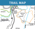
There are 27 kilometers of trails in five named loops. The South Loop (5 km) offers perhaps the easiest terrain. The North Loop (6 km) is more hilly and challenging than the South Loop, with long uphill and downhill grades. The Tram Lake Loop (3 km) has the most difficult terrain of the entire system and should only be skied by advanced level skiers. Two new ´lollipop-loops´ were added in 2009: Highland/Lowland Lake (7 km), and Dog Island Lake (6 km). Both feature scenic, intermediate terrain and can accessed from the North Loop.
There aren’t many trail junctions making this is a fantastic system for intermediate and advanced level skiers who just want to put their heads down and cruise, kilometer after kilometer.
All the trails are groomed for classic and skate, most are one-way. The trails are groomed often and well by the Friends of Hickory Ridge. There are two rustic, lean-to shelters on the trails with firepits.
"The Hickory Ridge Cross-Country Ski Trail was developed by the Chippewa County Forest and Parks Department. Labor for trail clearing was provided by the Wisconsin Conservation Corps…"
"No fees are required but donations are appreciated. There are donation canisters at the Dog-Island Lake Trailhead and the South Loop Trailhead. ALL donations are used to improve the Hickory Ridge Cross-Country Ski Trail!"
_skihickoryridge.com
LAND OWNERSHIP
The entire trail system lies within the Chippewa County Forest.
PARTNERSHIP / TRAIL MANAGEMENT
FEES
No fees are required but donations are appreciated.
FACILITIES
Parking, pit toilets, two rustic shelters
On-Site Equipment Rentals: No.
IN THE AREA
Motels, food, & gas (Bloomer), motels, food, gas, & retail sporting goods (Chippewa Falls, Eau Claire).
DIRECTIONS
On Highway 53, turn east onto Highway 64 and drive 6.1 miles (stay on 64 through several intersections!). Turn north onto County Highway AA and drive 3.6 miles to 226th Ave. Turn east onto 226th Ave and drive 3.5 miles to the trailhead parking lot entrance (226th Ave becomes 225th).
On Highway 64 turn north onto County Highway AA and drive 3.6 miles to 226th Ave. Turn east onto 226th Ave and drive 3.5 miles to the trailhead parking lot entrance (226th Ave becomes 225th).
TRAIL INFORMATION
Website: Hickory Ridge Ski Trails
Phone: 1.866.723.0331 (Chippewa County Tourism)